Project
- Stars
- Started
- Issues
- License
Add speed, map and elevation overlays to GoPro video
GoPro Dashboard Overlay is a command line tool that draws speed, altitude, slope, maps and other gauges onto GoPro video. It reads the GPS and sensor data embedded in the clip, or an external GPX or FIT file, and renders the result with ffmpeg.
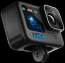
It can also convert a clip's telemetry to GPX or CSV. The README says the HERO9 GPS track is poor, so you can supply a GPX file from another device, and that HERO11 GPS is much better.
You need Python, ffmpeg and a few system libraries; it has no window. The README says it was tested on a HERO9 and a HERO11 only, so other models depend on sample files.
How did it go? Tips, problems, questions…
Add speed, map and elevation overlays to GoPro video
GoPro Dashboard Overlay is a command line tool that draws speed, altitude, slope, maps and other gauges onto GoPro video. It reads the GPS and sensor data embedded in the clip, or an external GPX or FIT file, and renders the result with ffmpeg.
It can also convert a clip's telemetry to GPX or CSV. The README says the HERO9 GPS track is poor, so you can supply a GPX file from another device, and that HERO11 GPS is much better.
You need Python, ffmpeg and a few system libraries; it has no window. The README says it was tested on a HERO9 and a HERO11 only, so other models depend on sample files.
James Richardson and 21 others
27 followers · joined Sep 2010
Feedback
How did it go? Tips, problems, questions…