Project
- Stars
- Started
- Issues
- License
Plan DJI mapping routes in QGIS
FlyPath adds mapping and inspection flight planning to QGIS. It creates routes and camera actions for supported DJI waypoint aircraft, including verified Mini 4 Pro and community-verified Mini 5 Pro workflows with the RC2 controller. Local planning does not require a FlyPath cloud account.
Use QGIS on Windows or Linux with the documented Python dependencies and the release’s exact aircraft profile. RC2 transfer replaces an existing native waypoint mission slot, so preserve any mission you want to keep and reopen DJI Fly afterward. Terrain data describes ground elevation, not every tree, wire or building. Check altitude references, photo behavior and the imported route before flight.
How did it go? Tips, problems, questions…
Plan DJI mapping routes in QGIS
FlyPath adds mapping and inspection flight planning to QGIS. It creates routes and camera actions for supported DJI waypoint aircraft, including verified Mini 4 Pro and community-verified Mini 5 Pro workflows with the RC2 controller. Local planning does not require a FlyPath cloud account.
Use QGIS on Windows or Linux with the documented Python dependencies and the release’s exact aircraft profile. RC2 transfer replaces an existing native waypoint mission slot, so preserve any mission you want to keep and reopen DJI Fly afterward. Terrain data describes ground elevation, not every tree, wire or building. Check altitude references, photo behavior and the imported route before flight.
dronnix-io
On GitHub
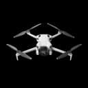
DJI camera drones
Feedback
How did it go? Tips, problems, questions…